Showing posts with label photos. Show all posts

Sunday, May 29, 2011

RE: Back to the field...

Almost a year blogging hiatus. I just don't find the time to write sophisticated blog posts on things that are interesting enough. The last year has been pretty busy and there are several manuscripts under review, in preparation or whatever. As soon as some stuff is finally published, I will share some potentially intersting results here. For the time being, take a look at some photographs that I took on the field season last year. In August 2010, I spent four weeks in the western U.S. to get more data on Early Triassic ecosystems from western Pangaea. It's, of course, not purely geologic. Fieldwork is always an experience. Enjoy the shots!


The camp in the Confusion Range. The bright spots are ant nests.


Sunset at the Utah/Nevada-border.


A Great Basin Collared Lizard (Crotaphytus insularis)
seen near Notch Peak, House Range.


Notch Peak, Sawtooth Mountain, House Range, Utah.


A pissed-off Western Black Widow
(Latrodectus hesperus) in my bowl.


The Meekoceras-Inn fighting with the wind.


A rotten Pick-Up-Truck in middle of Tule Valley.
Cambrian rocks of the House Range in the background


Death Canyon, House Range Utah.


Death Canyon, House Range Utah.


Fossil hunting in the Wheeler Shale, House Range, Utah.


A nice evening in the House Range.


Ruins near Santa Clara, Utah.


Shales of the Virgin Formation (some people consider it as a Member).


In the desert west of St. George having a view on
outcrops of the Moenkopi and the Chinle Group.


Me, finding some cool traces.


A dead Desert Horned Lizard (Phrynosoma platyrhinos).


These are the guys I am looking for. I prepare the plates
for later publications directly in the field, haha.


Double rainbow.


Bivalve resting traces Lockeia, Dinwoody Formation, Montana.


Although fully overgrown, these are textbook-like triangular fault
facets and an alluvial fan in between. This seems to be a very
prominent example. It pops out of the internet here and there.
Tendoy Range, near Lima, Montana.


Eumorphotis (left) and Claraia (right), Dinwoody Formation.
Probably the most common bivalves of the Early Triassic.


Hidden Pasture. What a place! Tendoy Range, Montana.
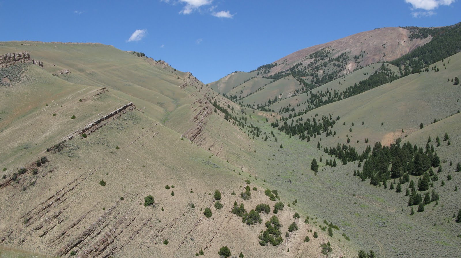

The Dinwoody Formation at Hidden Pasture.


Somewhere in the southern Tendoy Range, Montana.


My car.


Cattle eating gras near Lima, Montana.


Reminded me on " Little House on the Prairie", Ovid, Idaho.
Sunday, May 16, 2010

Accretionary Wedge #25: Geo-Image

The current edition of the "Accretionary Wedge" is hosted by Highly Allochthonous. The motif this month is to gather geology-related images. Outcrops, sections, satellite images, minerals, fossils, seismic images, diagramms etc.

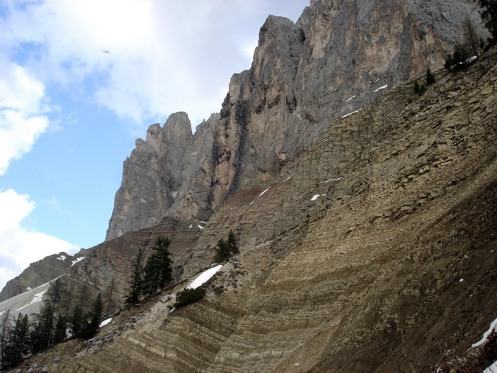
Here is mine: The Permian-Triassic transition epxosed at the Northface of the "Aferer Geisler" (Dolomites, Northern Italy).


The Bellerophon Formation (the brown/yellow succession in the lower part) represents late Permian (Changhsingian) shallow marine to marginal marine environments that yield insight into the pre-extinction world. The end-Permian mass extinction is suggested to have wiped out about 95% of all marine species, and thus is considered as the most severe biotic crisis that metazoan life encountered on our planet. The Werfen Formation (the grey to reddish slope in the middle part of the picture) extends from the latest Permian (latest Changhsingian) to the lower Triassic (Induan/Olenkian) and is one of the best studied succession of the end-Permian mass extinction and its aftermath. In this picture, the extinction level is exposed approximately where the trees end. The steep cliffs forming the top of this range are composed of reef carbonates for which the Dolomites are so noted.

The Dolomite region has been selected as a Unesco World Heritage site. Besides the breath-taking beauty of this landscape, the significance of this region for earth sciences has also been taken into account.

Sunday, November 29, 2009

Hammer Party

Sorry, it is Sunday, I finished my tasks scheduled for today (building up an ikea-something) and my significant other is trapped in a synchrotron somewhere in France. Let me dump the internet with useless information (nothing new, actually).

Probably on every student field trip a picture like this is going to be taken. It was a third years field trip, so you still see tools from DIY markets, which are infact unsuitable for torturing rocks. They easily chip. I once shot a fellow student in the leg while I tried to decompose a cherty limestone. Blood everywhere, I tell you. She sued me and I still have to pay her smart money. So get decent gear for fieldwork. Safety first!

Some details of the story are exaggerated to justify a blog post but basically it's true.

Thursday, November 19, 2009

From the east coast to the west coast...

Recently, I returned from a field trip with American (Jim Jenks and Kevin Bylund) and French (Dr. Arnaud Brayard) Cephalopod researchers. I have been in the south-western U.S. for almost 4 weeks to see the Panthalassian faunas mainly of the Smithian and Spathian (Upper Early Triassic, Olenekian if you want). I've got a lot of things to do right now so I just will post some pictures from the field trip and some ichnologic goodies. Almost everything that is suggested for publication will emerge here (if any) after definite publication. It is not that I am conceited or afraid that someone snitches my ideas but most journals require that the submitted material is not published elsewhere in any form (hence, including blog-posts). In fact, currently I am working on a manuscript on some trace fossils from the Dolomites that I'd love to show you. Anyway back to the U.S. (as always: click to enlarge!):

The ?Thaynes Formation at the Dog Valley locality (Pahvant Range, central Utah).


Our camp with the Thule Valley in the background seen from the Disappointment Hills (Confusion Range, Utah) . The backmost mountains belong to the House Range and are mainly composed of Cambrian sediments.


One of the sections at the Disappointment Hills locality. The succession of interest starts at the right with a calcarenitic bed (the bright bedding plane) blanketing a ?permian paleo-relief. The Triassic here is represented by the Thaynes Formation (Smithian and Spathian) .


Well, the desert can be a lonely place...


...but furry guests show up from time to time.


Thats a locality called Smiths Phalen Ranch near Currie (Nevada). See the post on Ammonoidea.


"Superb" outrcop conditions in NE-Nevada (Winecup Ranch, or something). We weren't even sure if its Lower Triassic at all.


The morning after a 25°C drop in temperature.


The Spathian Virgin Member (stratigraphic nomenclature is debated, some researcher refer to the Vrgin Limestone Formation) near Hurricane. Basically, a shale interbedded with a series of prominent limestone ledges.


The lowermost of such "ledges", here very variable in thickness. It pinches out towards the left. I think it represents an estaury filling incisions in the underlying terrestrial red beds. The base of the Virgin member is highly variable in facies. It must have been a very dissected coastline with shoals, tidal flats, lagoons and estuaries. Honey Moon Trail east of the Hurricane cliffs.


The same little mesa showing the prominent pinch-out towards the left.


The Hurricane Cliffs east of Hurricane (Utah).


So called "wrinkle structures". Little pseudo ripples which are formed by microbial mats. It is considered as an "anachronistic" facies showing up in areas or times when grazing and bioturbation in general is dramatically reduced due to nonexistence of grazers and burrowers (Lower Cambrian) or as a result of a previous massive extinction (Lower Triassic). If you are interested read Pruss et al. 2004 for instance.


An ichnologic goodie: Cruziana in the lower Triassic. Usually, Cruziana is suggested to have been produced by Trilobites. As they went extinct in the course of the end-Permian mass extinction, similar structures can be obviously produced by someone else. A paper dealing with this topic is Zonneveld et al. 2002. The occurence reported in that reference is dated to the Middle Triassic. So my specimen (Spathian Virgin Member) should be the earliest large Cruziana after the end-Permian Mass extinction found so far. Well, the photographed specimen is not the whole story and I hope I can come back to this one when we have better data and a publication.


Me and my little clam truck.


References

Pruss S. B., Fraiser M. L., Bottjer D. J. 2004: The proliferation of Early Triassic wrinkle structures: implications for environmental stress following the end-Permian mass extinction. Geology, 32, 461–464.

Zonneveld J. P., Pemberton S. G., Saunders T. D. A., Pickerill R. K., 2002: Large, Robust Cruziana from the Middle Triassic of Northeastern British Columbia: Ethologic, Biostratigraphic, and Paleobiologic Significance. Palaios, 17, 435-448.

Monday, August 10, 2009

South Tyrol/ Italy II (July/ August, 2009)

I am just back from a short 9 day field session again in the Dolomites. We completed the documentation of the Werfen Formation at the San Pellegrino and started to log and sample an additional section at the Rosengarten/ Catinaccio with some surprising results. I will get back to it later when I have a sound database. Just for the record: trace fossils are awesome. Haha.

The Rosengarten/Catinaccio section exposing the lower Werfen Formation (click to enlarge). Not to scale due to perspective distortion in the upper part. Whole outcrop represents approximately 90 metres of exposed strata. Oh, I forgot to indicate that the extinction level roughly represents the Permian-Triassic boundary.

Friday, July 10, 2009

South Tyrol/ Italy I (May, 2009)

Here are some rather touristic impressions from the field campaign (click on the pcitures to enlarge). The task of the first session was to find appropriate sections...

The Peitlerkofel (Sas de Pütia) as seen from "Würzjoch". As you see there is still plenty of snow in May. We were'nt able to document a section here. The reddish/grey slope in the foreground is Grödner Sandstein Formation (Permian). Terrestrial plain and river sediments. The Permian Bellerophon Formation and the Permotriassic Werfen Formation is well-covered with snow.


The Permian Grödner Sandstein of the Bletterbachschlucht. Supervisor for scale in the lower left. This is a spectacular gorge. Unfortunately the upper part of the canyon was not accessible due to floods earlier this year. So we did'nt see the P/T boundary below the Weisshorn.


The Werfen Formation below Cimon della Pala at Passo di Rolle. In fact a nice outcrop but very risky when it comes to sampling and documenting the section.


Me on the way to Cima dell Uomo above Passo San Pellegrino. Snow everywere.


The Bellerophon Formation at the slopes of the Aferer Geisler seen from the Günther Messner Steig.

Me for scale at the Val Badia Member (Werfen Fm.), Val a Averta


Packing samples after 5 days of work at the Aferer Geisler section.


The upper 30 metres or so of the Aferer Geisler section (Seis Member). Supervisor (black something) for scale somewhere in the lower left.


The lower Werfen (from lower right to upper left): Mazzin Member, Andraz Horizon Member, Seis Member, ?Gastropod Oolith Member and Campil Member (red). The photo is taken from the slopes between Cima dell Oumo and Costabella (Passo San Pellegrino).


The upper Werfen below Costabella. It does'nt look spectacular but it is the best outcrop seen so far to see the complete upper Werfen Formation without breaking my neck. It is just too far to identify the members from this perspective.


These dudes saved my life several times i guess.


There it is: The End-Permian Extinction level at Rosengarten/Catinaccio. The lower bed is full of shelly fossils whilst the upper bed is devoid of life. Certainly, you can see such contrasts in other settings as well merely due to facies change or something but the following beds yield almost no fossils. Some authors refer to the "End Permian Death Zone".


Trees.


Cimon della Pala seen from Val Venegia.


I won't take this way.


San Pellegrino seen from Costabella.


A similar view 13 days earlier.


A typical Dolomite landscape in Val Badia near Misci and Seres. The mountain in the background should be Kreuzkofel (Sasso Croce).


Latemar seen from Rosengarten/Catinaccio.


A Bob Ross painting: Karer See with Latemar.


Cimon della Pala from Val Venegia